We went to Santa Fe to peruse the galleries on Canyon Road today. We saw so many beautiful paintings and sculptures, but of course you can't take photos of them, so please enjoy some of the outdoor scenes and the architecture instead.
...and of course, I got lost in the children's section of the bookstore.
Saturday, November 26, 2016
Tent Rocks National Monument
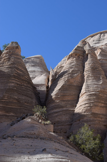
Tent Rocks National Monument is part of the Cochiti Pueblo. Visiting Tent Rocks has been on my to-do list for a couple of years. Only an hour and fifteen minutes from home, it is an otherworldly landscape of volcanic tuff and ash eroded into cones and fantastic shapes.
The Cave Loop trail is a little over a mile long. Branching off that trail is the 1.5 mile Canyon Trail which takes you up through the slot canyon to a high point with 360 degree views. The sign warns of flash floods. I'm assuming that the rangers would have closed the park had that been a danger...
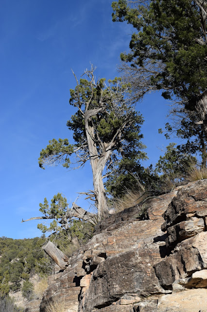
I'm right next to the trail here, but we enjoyed the illusion that I was far up a rock.
Tent Rocks is a popular destination, and it was the middle of a holiday weekend. Stephen had to create a parking spot for the truck because there were so many visitors. This made the last ascent to the top pretty slow as the trail was narrow with stone or wood steps. We stopped many times for people to come down before we could go up. Consequently, Stephen didn't take as many pictures of that part of the trail because he didn't want to hold up the people behind us. At one point he stepped aside to take a photo and I got in the middle of a group of faster hikers. I stayed with that group to the top, arriving about 8 minutes before Stephen. I was astonished at the number of people who made it to the top who did not look like seasoned hikers, with inappropriate footwear, impractical outfits, small children, etc.
The views from the top were spectacular. There was just a slight breeze. The temperature was around 50, and it felt quite warm in the sun.
By the time we headed back down the crowds had thinned a bit and we were able to take a little more time for photos. The light was different by then as well.
When we got to the intersection of the two trails, Stephen decided to go straight back to the truck while I did the Cave Loop. I walked uphill to the cave and took a quick look, then jogged down through the tents to the parking area. It felt good to stretch my legs after having to go slowly down the steps and through the slot canyon. I actually made it back to the truck before Stephen. We had a snack and were on our way.
We left Tent Rocks and drove out to Cochiti Lake, formed by Cochiti Dam. There are many more hiking opportunities there, and it's so close to Albuquerque that I'm sure we'll go back and explore the area.
Friday, November 25, 2016
Thanksgiving Day -- Sandia Cave
Stephen came up with the plan for Thanksgiving day. While he worked on Wednesday, I made way too much food in preparation. Wednesday night we went out to El Patron for blue corn enchiladas, then to Lizard Tail Brewing to hear some jazz.
We had some things to take care of Thursday morning so we didn't head out until after lunch. We drove up to Bernalillo to take the dirt road up the back of Sandia Mountain.
Three miles on the unimproved road brought us to the parking area for the trail head. At this point we had seen a dusting of leftover snow but Stephen had not needed four wheel drive. It was warm in the sun but quite brisk in the shade so we layered up and brought hats and gloves.
You can see our destination in the next photo: the stairs to the cave.
Here is what one website says about Sandia Cave:
The site is located high on the east side of Las Huertas Canyon in the northern Sandia Mountains. The mouth of this limestone cavity is small, its open length is 127 yards, and in only a few interior places may a person stand erect. Frank Hibben (1910-2002) of the University of New Mexico conducted excavations in the cave from 1937 through 1941 in an attempt to associate prehistoric humans of the “Sandia culture” with extinct Pleistocene mammals. Hibben argued that “Sandia points” represented a culture that predated both Clovis and Folsom. Controversy erupted regarding the true age of the points, as other archaeologists questioned the cave’s proper stratigraphy and whether Hibben himself had planted the artifacts. Following a series of published academic articles questioning the veracity of the finds at Sandia Cave, Hibben’s work was discredited. However, the debate that ensued over Sandia Cave continues to be taught in the history of Paleoindian and Southwestern archaeology. Popular and professional articles revisiting the site and discussing the Hibben controversy continue to be published into the 21st century.
We didn't go very far into the cave, not being prepared with helmets and lights. But I climbed into the second chamber and looked into the tunnel past that point.
After our hike we continued up the back of the mountain to intersect with the paved road. This sign says, "Road closed for winter; proceed at your own risk." Stephen tried to tell me it said, "proceed at your own PACE." I did not believe him.
Me: Don't drive me off a cliff.
Stephen: Yes, yes, you've made it perfectly clear that you don't like that.
Me: Well... to be fair, it has been more than 20 years since you've driven me off a cliff.
Stephen: Yes! Ever since you said you didn't like it!!! See?
Me: I didn't think I had to say it... but OK.
We caught the sunset on our way down the mountain, arrived safely home, and ate our Thanksgiving dinner. Harvest stuffed acorn squash, garlic-glazed green beans, mashed potatoes, sensational stuffing with nuts, roasted Brussels sprouts with apples and onions, and pumpkin pie. What a day!
Subscribe to:
Comments (Atom)


